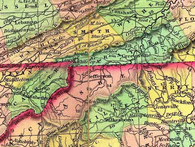
Map of the New River Valley — 1835
The following map was provided by Fred Smoot for inclusion in this web site. 21It was drawn in 1835, please note that Ashe County contains Alleghany and Watauga Counties at the time and that Grayson County covered what is now Carroll County. Smyth County is shown, which certainly dates the map between 1832 and 1842.

